Special Reports

Hazelwoodians Tell PRT, ‘We Need the 93!’

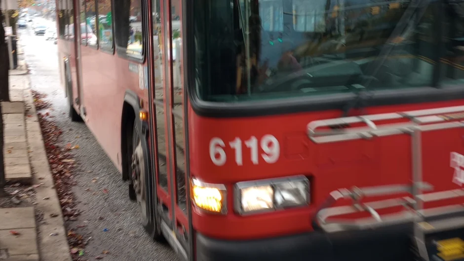
The inbound 93 bus stopped at Second and Flowers avenues. Photo by Juliet Martinez

After Pittsburgh Regional Transit released the first draft of its Bus Line Redesign project on Sept. 30, Hazelwood resident Tiffany Taulton had one top concern: How will her son and his classmates get to school at Allderdice? The plan eliminates the 93 bus line and replaces it with routes that don’t have stops in Squirrel Hill, Shadyside or Lawrenceville.

“Without the 93 bus, there is no connection to Squirrel Hill that gets [students] to school on time and safely,” Ms. Taulton said on Nov. 13.

On Nov. 12, the agency formerly called Port Authority, now known as PRT, gave a presentation on their new plan to the Hazelwood community meeting — where they heard many similar concerns from Hazelwood residents.

Proposed Hazelwood changes

About 35 people attended November’s monthly meeting in person and, another 20 used Zoom. Emily Provonsha, PRT’s manager of service development, said PRT is in its first phase of getting feedback about the proposed plan. As the weather gets colder, she said, they are planning fewer “pop-up” events in different neighborhoods. But people can still comment online until at least Jan. 31, 2025.

PRT will share another draft of proposed changes they are calling “draft 2.0” with the public sometime this spring. The new draft will incorporate the feedback they are hearing at events and meetings like this one. Stops for the new routes have not been proposed yet.

“One of the changes proposed in the first draft that reflects changes in transit demand after the pandemic is the proposal to discontinue many of the commuter flyer routes,” Ms. Provonsha wrote in a Nov. 14 email. “The ridership on many of the commuter flyer routes remains very low and has not recovered after the pandemic. That being said, we will take another look at this based on public feedback we receive and refer to more recent ridership data as well. In the first draft, given our constraint of having the same operating budget and number of bus operators, we redistributed service hours from the commuter flyer routes and put them into standard bus routes that operate all day, 7-days a week, and this increased trips throughout the midday and on weekends for many of our local bus routes.”

Ben Nicklow, a senior planner at PRT, listed and explained the new routes that would go through Hazelwood: D44, D52, and O53. A fourth route, N94, skirts the edge of Hazelwood. He also mentioned X50, which follows the route of the existing 61C route; and O50, which follows the route of the existing 61D. Those two routes do not go through Hazelwood, but they have stops near Hazelwood and could be reached by transfer.

“You will be able to connect to [X50] through the Waterfront,” Mr. Nicklow explained. “When you need to go somewhere in that service area, even if it looks like it’s not quite in the same travel corridor you do currently, it may come so often that even if you have to transfer it’s a quicker trip.”

Where Hazelwoodians are going

The team from PRT seems to have thought that Hazelwoodians travel to the Waterfront a lot more and to Squirrel Hill (along with other uphill neighborhoods) a lot less than they actually do.

When they took questions from meeting attendees, the questions centered mostly around the need for a direct connection between Hazelwood or Glen Hazel and Squirrel Hill. Attendees wanted one-seat rides to places other than Oakland and the Waterfront. Parents were concerned about their children getting to Allderdice.

Ms. Provonsha told me, “PRT recently held a stakeholder meeting in which we invited school Transportation Directors from all schools throughout the County to discuss their proposed changes and ask them to share data with us on where their students travel from to go to each school, so that we can compare those trips with the transit network.”

“I think they were surprised,” Ms. Taulton commented about the meeting. “I don’t think they realized the 93 was so critical, that people were using it to get to Squirrel Hill so much.”

She uses the 93 to get to work, do light grocery shopping, and get to her mom’s eye doctor, among other places. Hazelwood residents are going to Squirrel Hill not only for the necessities they lack in their own neighborhood, but for connections to the larger community.

Besides grocery stores and banks, Ms. Taulton and several other meeting attendees mentioned Zone 4 safety meetings in Greenfield and the JCC in Squirrel Hill. The JCC has the only pool nearby and offers activities for seniors. They also hold public meetings there.

Mary Bartol, who lives in Hazelwood, commented about the 93 at the Nov. 12 meeting.

“It satisfies every need we have because you can get off in Squirrel Hill to Schenley Park, then into Oakland — then you can go into Shadyside, get off anywhere there.” She said she sometimes visits Bloomfield and Lawrenceville and mentioned the new grocery store being built on Butler Street.

“We’d be lost without it,” Ms. Bartol said.

Lincoln Place PRT riders

Because PRT’s proposed changes are so complex and far-reaching, this article is one in a series. The next article planned is about Lincoln Place. Please email us at junctioncoalition@gmail.com if you want to be interviewed about how the bus line redesign would affect you.

You can review the Bus Line Redesign proposal, comment to PRT, and get the latest on meetings at PRT’s Bus Line Redesign website.

This article originally appeared in The Homepage.

15207 May Be Hit Hard by PRT Bus Line Redesign per Current Proposal

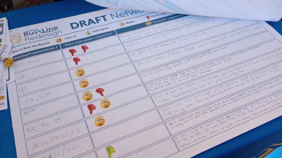
A feedback sheet at the Oct. 21 PRT pop-up event at the Giant Eagle on Murray Avenue shows thumbs-down and mind-blown stickers along with rider comments like, “Less options for the children to get to school in this city!!!”

On Sept. 30, Pittsburgh Regional Transit (formerly Port Authority, now known as PRT) released the first draft of its Bus Line Redesign project.

Their proposal completely reroutes many transit lines. It also includes new schedules and new names for all the routes in the system. Because the changes are so complex and far-reaching, this article is the first in a planned series.

As it stands, PRT’s plan contains grim surprises for residents of Greenfield, Greater Hazelwood, and Lincoln Place. Future installments will focus on each of these areas.

Service cuts in parts of Greenfield

PRT’s interactive map shows a hole on Greenfield Avenue, where the 58 bus line now connects Second Avenue with Greenfield and other communities at the top of the steep hill. The redesign appears to merge the 58 with the 65, which now runs between Squirrel Hill and downtown.

As a result, people who live in upper Greenfield and work downtown would be redirected through Oakland. People who live in lower Greenfield and can’t walk up the hill would be cut off from the rest of the neighborhood. Greenfielders, who have long enjoyed the benefits of the neighborhood’s central location, could see their bus commute time double.

“I don’t understand it, why you just keep cutting, cutting, cutting, cutting,” said transit rider William Shorter at an Oct. 21 PRT pop-up event at the Giant Eagle on Murray Avenue. “People need these buses.”

“It would suck,” said Patrick Hassett, who has lived in Greenfield since 1989. “It would suck for me, my elderly buddies, and businesses that depend on transit for their employees and customers.”

Mr. Hassett said he has spoken with proprietors along Greenfield Avenue who are concerned that the route changes will make it difficult or impossible for people to get to their business.

Although Mr. Hassett considers himself a Greenfielder first since his retirement, he earned degrees in planning and transportation and worked for the City of Pittsburgh for 26 years in transportation and development.

When we met on Oct. 9 to review the map, Mr. Hassett identified Greenfield and Murray avenues as the two main commercial corridors that serve Greenfield.

“The most important transit spine is Greenfield Avenue,” he said. “Murray Avenue doesn’t penetrate the neighborhood like Greenfield Avenue does, although its commercial district is important.”

Pittsburghers for Public Transit’s director of communications and development, Dan Yablonsky, said the organization is holding meetings about the Bus Line Redesign every week to better understand what is being proposed and to shape their response.

Prioritizing bus rapid transit

The proposed plan’s effect on Greenfield is the opposite of PRT’s stated goal to “prioritize equitable investment by aligning service with land use and socio-economic changes.”

The source of the disconnect in PRT’s plan may be two-fold: the bus rapid transit model around which the plan is designed, and its “cost-neutral” funding scenario.

Mr. Hassett said bus rapid transit is not a new idea, and other cities like Kansas City and Indianapolis have been using it for more than a decade. Bus rapid transit focuses on connecting employment centers — in Pittsburgh’s case, downtown and Oakland.

“That system requires you to adjust the transit network so that service to the corridor is maximized. What suffers is local service,” he said.

“Right now, the buses filter through Pittsburgh’s many neighborhoods and smaller centers of employment,” he said. “The effect on Greenfield is obvious, but similar problems could occur with Lawrenceville, Squirrel Hill, and South Side [with this plan]. You still get local service, but it is less effective and more tuned to commuter needs. Many of the routes are redesigned to get you to Oakland.”

Mr. Hassett said discussions of bus rapid transit, or BRT, have been percolating in Pittsburgh for over a decade, too, but were previously shelved for competing transit priorities, plus a lack of funding and political support. He questioned whether the model of redirecting commuters to key job centers is an appropriate response to the effects of COVID-19 on transit demand.

“How have they modified the BRT model since the pandemic?” he asked. “You’d think people working from home would require more diffuse neighborhood service, not less.”

PRT’s cost-neutral plan means that the bus rapid transit investments would come at the expense of existing community services. In their Allegheny County Visionary Service report, Pittsburghers for Public Transit encouraged PRT to also consider versions of the Bus Line Redesign where service can grow with funding increases.

The Bus Line Redesign website includes a section imagining they will have 20% more funds. But those funds would not restore eliminated routes in neighborhoods. Instead, they are earmarked for increasing service on the proposed routes and establishing new “microtransit zones” in several neighborhoods including Oakland.

Mr. Yablonsky said, “We didn’t know what to expect, just that the framework they set up was cost-neutral. And like Laura [Wiens, executive director of Pittsburghers for Public Transit] always says, any redesign that doesn’t look at a growth scenario is rearranging deck chairs on the Titanic.”

Help turn this bus around

PRT says they are in the process of gathering feedback from transit users. At the time of this writing, they had scheduled several “pop-up” meetings for mid-October. You can review the Bus Line Redesign proposal and get the latest on meetings at engage.rideprt.org/buslineredesign/buslineredesign-home.

Mr. Hassett encouraged Greenfield transit users to ask themselves how the new routes would affect their ability to get to the Greenfield Giant Eagle, Magee Rec Center, St. Rosalia’s church, and other Greenfield destinations they need to visit. How much longer would the trip take, and how much more walking would be involved to get to the bus stop?

Pittsburghers for Public Transit says their organization is approaching the Bus Line Redesign with caution because of concerns like these. According to their website, their focus is “that PRT should ‘Do No Harm’ with the new design, at the least.”

Mr. Yablonsky invited residents of hard-hit neighborhoods to “organize with their neighbors and join up with [Pittsburghers for Public Transit].” He said the group will hold a Zoom organizing meeting on Nov. 13 from 7 to 8:30 p.m. where they will discuss the proposal and decide what changes to push for. Email info@pittsburghforpublictransit.org for details.

PRT will address the Greater Hazelwood community meeting on Nov. 12.

This article originally appeared in The Homepage.
Transit Report Urges Local Riders to Dream Big and Campaign Hard

Protester holding up sign that reads "Transit funding now!"

Advocates set 2020 transit levels as first milestone but aim to restore 20 years of service cuts

Big changes are coming to public transit in Allegheny County with Pittsburgh Regional Transit’s Bus Line Redesign project. As the public transit agency (formerly Port Authority, now known as PRT) prepares to release a draft of its plans in the coming weeks, Pittsburghers for Public Transit is encouraging riders to advocate for the service they need—and the funding to make it happen.

A vision for better transit

In August, Pittsburghers for Public Transit published a report titled Allegheny County Visionary Service that views the Bus Line Redesign planning period as an “opportunity to reverse the trend of budget and service cuts.”

The Bus Line Redesign will propose four versions of a revamped bus network. They will differ based on levels of funding: cost-neutral, 15% decrease, 10% increase and 20% increase.

According to the transit advocacy group’s report, our region has seen a more than 37% cut in public transportation service over the past 20 years. “That has led to a transit system that doesn’t go where we need it to go, long wait times between buses, and service that doesn’t always run at the times we need it,” the report states.

Against this dismal backdrop, it makes sense that PRT would prepare for more cuts, even though they would be catastrophic for an already gutted system. Redesigning the network with no change in funding would present problems of its own, because some communities would have to lose service to allow others to gain service.

Pittsburghers for Public Transit encouraged PRT to also consider versions of the Bus Line Redesign where the bus network can grow with funding increases. This would still leave much work to be done. Even a 20% increase in service would merely restore the amount of service provided before 2020. Although 2020 levels of transit service fell short of meeting community needs, the report calls for getting back to that level as an important first step.

‘Transit champions’ can help

The Allegheny County Visionary Service report identifies local, state and federal officials pushing to expand funding for public transit including the PRT.

Pittsburgh Mayor Ed Gainey’s transition team in 2022 recommended that the city work with PRT to “make its use easier and more attractive to encourage ridership” (p. 103). Their transition report showed an understanding of the need to improve transit service frequency and expand its hours.

Allegheny County Executive Sara Innamorato built her 2023 campaign partly on a platform of improving public transit.

In his 2024 budget address, Pennsylvania Governor Josh Shapiro called for increasing the state’s public transit funding by $282 million without levying new state taxes. PRT would receive $40 million of these state funds, which would increase their operating budget by more than 7%. In July, an $80 million stopgap was passed from the state’s surplus to the Public Transportation Trust Fund.

Reps. Summer Lee and Chris Deluzio are co-sponsoring the “Stronger Communities through Better Transit Act,” a federal bill that would provide funds to transit agencies of PRT’s size and larger. Allegheny County would receive an additional $175,586,810 in transit operating funding, allowing for up to 37% more service.

These funds could make a huge difference to riders and the whole region.

“It’s not just PRT that needs to hear from people, but also legislators,” Pittsburghers for Public Transit executive director Laura Chu Wiens said during a July 31 phone call.

Another bus line for Hazelwood?

In 2019, residents and organizations in Greenfield, Hazelwood and other communities worked with Pittsburghers for Public Transit to draft Our Money, Our Solutions, an alternative plan listing needed improvements that cost less than the Mon-Oakland Connector’s original $23 million budget.

The Mon-Oakland Connector envisioned a privately-run shuttle from Oakland through Schenley Park, Four Mile Run and Hazelwood to Hazelwood Green. The project, designed to serve university and research interests, was scrapped by Mayor Ed Gainey in early 2022 after years of community outcry.

The city and PRT adopted some items from Our Money, Our Solutions, like additional weekend service on the 93 bus line. Another top transit item, extending the 75 line across the Hot Metal Bridge into Hazelwood, has been under discussion. More transit funds and renewed local support could make the extended 75 line a reality.

It’s an example of what Pittsburghers for Public Transit would like to see happening throughout Pittsburgh’s neighborhoods.

“We hope people will be galvanized by the opportunities from getting more funding and what that would look like, how it could benefit their communities,” Ms. Wiens said.

Traffic-Calming Measures in Greenfield Leave Some Residents in Danger

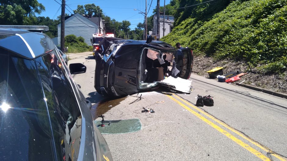
car wreck on Greenfield Ave. June 23, 2022

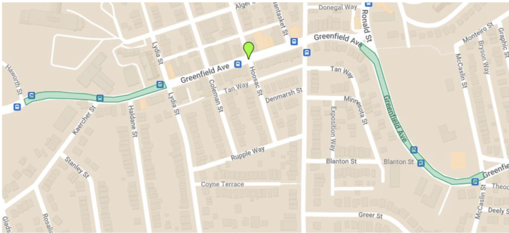
In the first week of July, Pittsburgh’s Department of Mobility and Infrastructure, known as DOMI, began its traffic-calming project along Greenfield Avenue. Crews installed speed humps and raised pedestrian crosswalks near Magee Rec Center and Greenfield School, and added rumble strips and extensive line painting. They also created a short bike lane that begins just past the 300 block of Greenfield Avenue.

It was a welcome sight for many Greenfielders, whose calls for traffic safety swelled after a car hit and injured a 12-year-old last summer near Magee Rec Center. But residents on the 300 block of Greenfield Avenue report little or no improvement when it comes to speeding drivers, even though they fought to have their area included in the project.

Two Greenfield Avenues

“I’m definitely seeing a complete change in traffic from Rialto’s around to the stop sign [at McCaslin Street],” upper Greenfield resident Annie Quinn said on July 14.

Addy Lord, a close neighbor of Ms. Quinn, agreed. “I think overall it seems as though people are slowing down around Magee,” she said. “Really thrilled about having the raised crosswalk.”

Catherine Adams co-chairs the Greenfield Community Association’s (GCA’s) Planning, Transportation and Development Committee.

“Anecdotally, traffic seems slower where the speed tables have been installed and I feel safer as a cyclist on Greenfield on the section where there is now a bike lane. But there doesn’t seem much of a change in rate of traffic speed or behavior change on the sections where the only treatment was paint,” she wrote in a July 14 email.

“Traffic calming on Greenfield Ave has been a long time coming,” Run resident Marianne Holohan texted on July 11. “We are honestly lucky that no one has died. I want to emphasize [that] more work remains to be done, especially in the 300 block.” Early last summer Ms. Holohan, secretary of the Greenfield PreK-8 Parent Teacher Organization, helped draft a traffic safety petition co-sponsored by the GCA. It garnered 600+ signatures.

An uphill battle continues

Since 2015, lower Greenfield residents have been requesting effective solutions for hazardous conditions on the busy 300 block, where vehicles often travel 40–50 mph. They report seeing frequent car crashes, including the destruction of parked cars.

The stretch is at the center of numerous major commuter routes, but many drivers do not respect it as a residential street. The Anderson Bridge closure detoured traffic to Greenfield Avenue and made the speeding even worse.

After last summer’s petition, public outcry over the child hit by a car, and pushback in response to Pittsburgh’s initial capital budget that left out traffic calming for Greenfield Avenue despite a 44% increase for its traffic safety program, DOMI finally agreed to include Greenfield Avenue — but not the 300 block.

Project area for Greenfield traffic-calming project. Source: https://engage.pittsburghpa.gov/index.php?cID=1605
The scope of the planned traffic-calming project for Greenfield Avenue completely excluded the 300 block, which is outside the project area shown in their plan. Source: Engage Pittsburgh project page

Only additional lobbying from frustrated residents and District 5 City Councilor Barb Warwick convinced DOMI to hold a neighborhood “walk-through” of Greenfield Avenue on March 5 to hear residents’ concerns and witness the dangers for themselves. DOMI agreed to add painted lines on the 300 block but, so far, no physical infrastructure.

Now that the work is complete, 300 block resident Paul Faust told us, “I think what they did with people driving downhill has them driving a little slower, but down [at Swinburne Bridge], as soon as [drivers] get past those rumble strips and curve they hit the gas. They floor it and are going 45 mph. At the least, they should put in a speed hump.”

The speed hump and raised crosswalk clustered together near the former St. Rosalia school are too far away to slow traffic where he lives, Mr. Faust said.

In a July 14 email, Greenfielder Ben Yogman praised the work in Upper Greenfield but wrote, “The absence of any marked crossing at all for residents of Tunstall Street and the 300 block is completely unacceptable. The danger here was highlighted at the start of the neighborhood walking tour with DOMI but they didn’t communicate that they were not including a crossing in their plan.”

On July 11, BikePGH advocacy manager Seth Bush took another walking tour with Junction Coalition to view and analyze DOMI’s traffic improvements.

“Unfortunately, cars [are] driving right over the paint on Lower Greenfield and zipping through just as fast as ever,” Mr. Bush observed. “There really isn’t any change. The bike lane helps slow folks down further up the hill, but drivers are ignoring the treatments otherwise.”

Mr. Bush said he believes some type of physical infrastructure is needed to make the 300 block safer.

Residents have discussed ways of slowing down traffic until city officials follow through on equitable traffic-calming measures, including installing their own.

A Neighborhood Changed Forever: The Parkway East and Four Mile Run

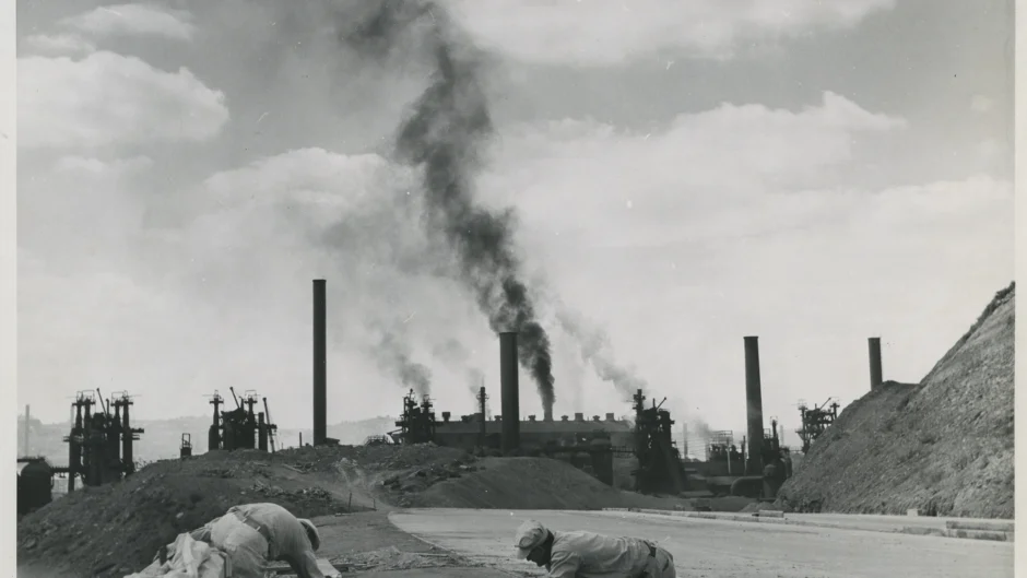
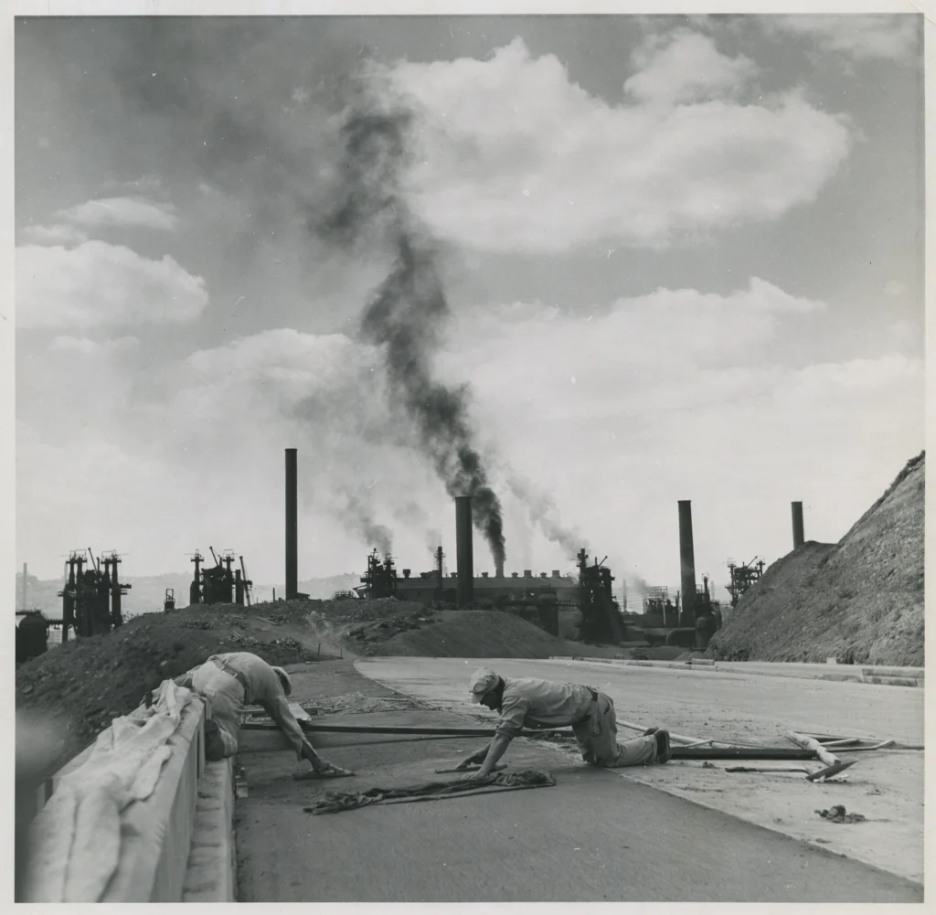
A construction crew works on the Junction Hollow Bridge along the Penn-Lincoln Parkway (Interstate 376), known as the Parkway East. Construction began on Nov. 14, 1949, and was completed on Oct. 15, 1952. Photo courtesy of the Allegheny Conference on Community Development Photographs, 1892-1981, MSP 285, Detre Library & Archives, Senator John Heinz History Center

Carol Rizzo Hopkins, 81, lived in Four Mile Run until moving to upper Greenfield at age 14. She clearly remembers a network of trails on the hillside. “Everywhere was a path, and we walked everywhere—Schenley Park, Squirrel Hill, Beechwood Boulevard, Magee Swimming Pool. We could be anywhere in two minutes.”

“Growing up in The Run was the best time of my life,” she told me during an in-person interview in December. “It was like a little village for us.”

But the Parkway changed all that. Now, as the Pennsylvania Department of Transportation (known as PennDOT) gets started on plans to improve the Parkway East Bridge over Four Mile Run, residents face the prospect of history repeating itself.

On Dec. 1, District 5 City Council member Barb Warwick posted on Facebook that PennDOT is conducting a feasibility study to explore their options for fixing or replacing the six-span bridge.

One option the department is considering involves building a new bridge beside the existing one — similar to their plan for the Commercial Street Bridge on the other side of the Squirrel Hill Tunnels. PennDOT would destroy the existing bridge and move the new bridge in to replace it. Using this method in The Run might shorten closure time on the Parkway East, but it may displace households near the bridge.

Two neighbors, Judy Gula and Ms. Hopkins, witnessed the original construction of the Parkway East bridge from 1949 to 1952.

Life in the Parkway’s shadow

Ms. Gula, 76, has lived in The Run her entire life — just like her father did. In her earliest memories, the Parkway was already under construction.

“We used to roller-skate on the Parkway before it was finished,” she recalled during an interview in December. “Kids rode their bikes and played up there. The construction workers would give us their empty pop bottles and we’d fight over who got them.”

Neighborhood children exchanged those bottles for two cents at Mary Kranyak’s candy store on Saline Street.

A construction crew works on the Junction Hollow Bridge along the Penn-Lincoln Parkway (Interstate 376), known as the Parkway East. Construction began on Nov. 14, 1949, and was completed on Oct. 15, 1952. Photo courtesy of the Allegheny Conference on Community Development Photographs, 1892-1981, MSP 285, Detre Library & Archives, Senator John Heinz History Center

Even after the Parkway opened, non-vehicular traffic continued for a time. Locals used it in ways people might find hard to imagine today.

“My dad and I would walk up to the Parkway to watch cars,” Ms. Gula said. “It was always backed up, even then.” As high school students, she and her friends would “walk the Parkway” to get to Allderdice.

Ms. Gula grew up in the shadow of the Parkway and with shadows of what it replaced. A school behind the apartment building where she lived was torn down, but she isn’t certain whether that was because of construction.

“My mother said there were steps from [The Run] to the Bridle Path [in Schenley Park] that were taken away by the Parkway,” Ms. Gula recalled.

She also remembers older relatives remarking how much quieter the neighborhood had been before the Parkway. Along with the wall of noise produced by speeding cars and trucks, the road brought other problems that continue into the present.

“We used to get all the water from the Parkway down here,” said Ms. Gula, who lives in the eastern part of The Run near the end of Saline Street. “Water used to come up to my [front] gate.”

About five years ago, crews added large rocks to slow water down in the area at the end of the street and behind the building colloquially known as “the pump house.” Ms. Gula says that has helped.

“It just destroyed us”

Ms. Hopkins’ grandmother, who lived on Naylor Street, had a small farm in the field beneath the Greenfield Bridge. The family’s seven children, including Ms. Hopkins’ father, took turns walking their cow to a nearby field to let it graze. By the time Ms. Hopkins came along, her grandmother no longer had the cow, but she still raised chickens.

The field near the pump house where the cow once grazed served as the local playground until Parkway construction began.

“They put all their equipment on our playground,” Ms. Hopkins said. She described large, hollow cylinders that looked like pipes wrapped in metal coils.

“I broke my arm,” she recalled. “I was running at nighttime, and I tripped over a coil lying on the ground. We couldn’t play there anymore.”

Of the displaced families and businesses, Ms. Hopkins remembers three in particular: the Marbella family, a market called Husky’s, and her friend Peggy. Peggy’s family lived in a stylish house with a lot of latticework.

“That’s where a pillar is now,” Ms. Hopkins said.

Ms. Hopkins and her friends and cousins from The Run still talk about the experience of having a highway carved through their idyllic neighborhood. “It affected us kids, and I’m sure the grownups,” she said. “People had cracks in their walls [from the construction] they had to fix.”

Follow this project

Councilmember Warwick encouraged people to sign up for notifications from PennDOT about the bridge project as it moves forward. She said the PennDOT team expects to have the first public meeting on its feasibility study in mid to late summer of 2024. Until then, she promised to include any new developments in the District 5 newsletter and the Facebook page for The Run.

Visit PennDOT’s project page for the feasibility study at http://tinyurl.com/Parkway-East-4-Mile-Run to see more details and instructions for getting project notifications. Visit the District 5 newsletter webpage at https://pittsburghpa.gov/council/d5-newsletters to sign up for monthly emails.

New Playgrounds for The Run, Greenfield School

Four Mile Run Playground almost complete

by Marianne Holohan

It’s been a good year for playgrounds in Greenfield. The rebuilt playground in The Run is finally open and a playground at Greenfield School is moving forward.

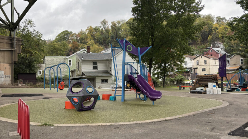
This fall, new playground equipment was finally installed in The Run. The City worked with neighborhood residents—including children—to design the new playground, which features more climbing options than the previous design.

Replacing the playground became a priority after a neighborhood girl was seriously injured due to rusty play equipment. This playground is a favorite among local kids, who like the fact that the parkway bridge shields them during rain, extending playtime.

At Greenfield School, the unsightly paved lot that has doubled as a play yard will become home to the first Community Schoolyard in Pittsburgh. A project of the Trust for Public Land, Community Schoolyards turns neglected public school play spaces in cities across the country into environmentally friendly, green play spaces that also double as outdoor classrooms. TPL worked with the Western PA Conservancy to launch the project at Greenfield School. 

The partnership unveiled their design for the new schoolyard in September. It will feature traditional playground equipment along with a track, basketball hoops, new trees, and green spaces. TPL worked directly with students to design the schoolyard, which will be open to the community outside of school hours. Construction is slated to begin in summer 2024.

These new playgrounds have been hard-won, with residents advocating for them persistently over many years. They are a positive example of what’s possible when the City and nonprofit organizations invest in our communities’ future.

District 5 Residents Voice Priorities for 2024 Budget

Greenfield residents and City Councilor Barb Warwick speak with DOMI representatives

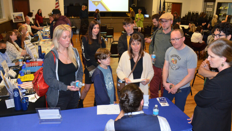
On Oct. 24, about 60 Pittsburghers gathered at the Pittsburgh Firefighters Local in Hazelwood for a budget engagement meeting with city officials. It was the final meeting in a series of five throughout the city to get feedback on the preliminary budget Mayor Gainey’s office is proposing for next year.

Budget basics and a high-tech twist

Patrick Cornell, chief financial officer of Pittsburgh’s Office of Management & Budget (OMB), presented the city’s process for creating budgets and finalizing them with community feedback throughout the year.

Mr. Cornell also explained the difference between operating and capital budgets and went over broad highlights of the real 2024 budget. These included increased funds for keeping bridges and roads safe and maintaining community assets like rec centers.

He invited attendees to try creating an imaginary $1 million budget using a budget simulator. A separate feedback tool on the city’s website, Balancing Act, lets users submit their ideal capital and operating budgets.

When asked if the city has a process to use feedback from the budget simulators, Mr. Cornell said he introduced them as a pilot program this year so there is no formal process yet, explaining they would need to create a citywide campaign and leave the simulators open for longer.

Residents share their priorities

In the second half of the meeting, attendees circulated around the room, talking to representatives from city departments.

The Greenfielders we interviewed all named traffic calming on Greenfield Avenue as an urgent priority. The budget includes a 44% increase in funding for traffic calming projects, but Greenfield Avenue was not selected.

“We have no school zone,” Eric Russell said. “The cars on Greenfield Avenue go extremely fast. That’s where the Rec Center is, the playground.”

“You go to Squirrel Hill or Shadyside; I’ve seen so much traffic calming there, but nothing in Greenfield,” he added.

Anna Dekleva, organizer of a recent protest demanding traffic calming on Greenfield Avenue, wrote in an Oct. 25 text that department representatives did not provide a lot of specific guidance.

DOMI’s representatives seemed unaware of a petition for traffic calming the Greenfield School PTO and Greenfield Community Association submitted to them over a month ago, she said.

“[District 5 Councilmember] Barb Warwick is a tremendous ally and committed to this concern and through her partnership I see the most capacity to change on this issue now,” Ms. Dekleva added.

Other attendees’ priorities revolved around people, housing and green spaces.

Saundra Cole-McKamey of Hazelwood said her top priorities are “more funding for youth and senior programs, more money for low-income housing, more money for the food justice fund and grassroots organizations.”

Teaira Collins of the Hill District emphasized fixing the crosswalk signs on Second Avenue and affordable housing built to suit children with disabilities. “I had to move out of Hazelwood for one reason: no tub. My son has Down syndrome and sensory issues; he can’t take showers.”

Jazmyn Rudolph of Mt. Washington said, “There are a lot of vacant lots, so it
would be great if we could use those for youth to learn about farming.”

“I want them to build a playground down below the tracks,” commented Hazelwood resident Bob White. “There used to be one on Blair Street that was there when I was a kid.”

You can find the preliminary budget and simulator tools at https://engage.pittsburghpa.gov/2024-city-pittsburgh-budgets.

Juliet Martinez co-wrote this article, which originally appeared in The Homepage.
Community Action Calls Attention to Traffic Dangers on Greenfield Avenue

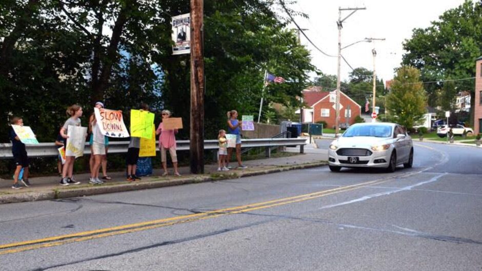
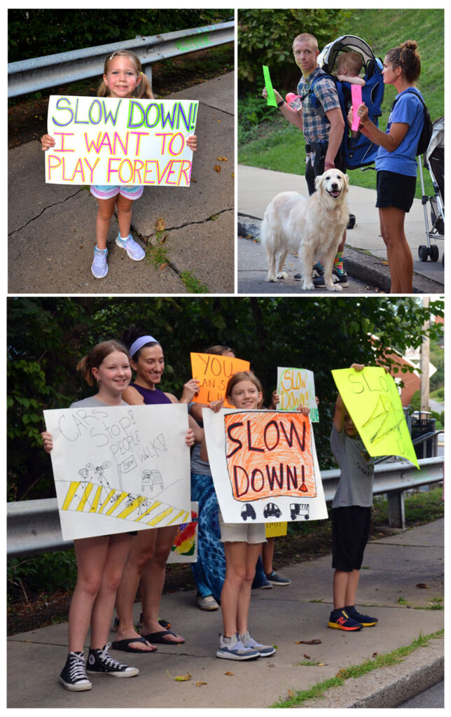
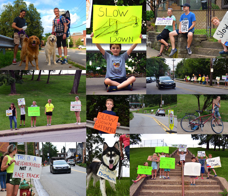
Slow Down Greenfield action on Aug. 25, 2023

At the tail end of rush hour on Aug. 25, more than 60 Greenfield parents and school-age children—some accompanied by family dogs—stood along Greenfield Avenue holding handmade signs that encouraged motorists to drive safely. They were taking part in Slow Down Greenfield, a street action organized by Greenfield resident and mother of three Anna Dekleva.

Ms. Dekleva told us she started Slow Down Greenfield in the wake of an Aug. 16 accident on the dangerous street that injured a 12-year-old and in support of a petition co-sponsored by the Greenfield School PTO and the Greenfield Community Organization (GCA).

Obvious, long-standing danger zones

The Keep Kids Safe with Traffic Calming on Greenfield Ave! petition asks Pittsburgh’s Department of Mobility and Infrastructure (DOMI) to restore the school safety zone around Greenfield School and Yeshiva School (formerly St. Rosalia’s). It also calls on DOMI to add traffic-calming and pedestrian safety features on Greenfield Avenue at its intersections with Ronald and McCaslin streets, as well as the stretch between Kaercher and Irvine/Saline streets.

Concerns escalated after 12-year-old Cameron Grimes was struck and injured near the McCaslin intersection named in the petition. Children and seniors frequently cross there to access Magee Playground and Magee Rec Center. And residents south of the Kaercher intersection have witnessed numerous wrecks, totaled parked cars, sideswipes, and countless near misses over the years. More than 560 people have signed the petition so far.

We have needed traffic calming and ways for students to safely walk to and from school, and to and from the rec center, for years. Now a child has been hit. What will it take? I recently stood with my child at a STOP SIGN for three cycles before cars actually let us cross Greenfield at McCaslin. Cars never slow down at Greenfield and Kaercher, even though there is a cross walk. Motorists are not safe in this space and we need engineering to make them be safe.

—Petition comment

Greenfielders speak out

Catherine Adams, who serves as co-chair of the GCA’s Planning, Transportation, and Development Committee and co-wrote the petition, attended the action and lauded Ms. Dekleva’s quick organizing.

“This type of event is an easy way to build and strengthen the community,” she told us in an Aug. 27 email. She noted that along with driver awareness, “we also need infrastructure that prevents vehicles from traveling at high speeds in areas with a lot of pedestrians, many of them kids. A speed limit sign doesn’t prevent a vehicle from traveling too fast, but infrastructure changes can.”

“A lot of the drivers who passed us slowed down, gave us thumbs up and waved,” observed Daniel Tkacik, who participated with his 18-month-old son Felix and family dog Louie. “Greenfield is a neighborhood full of families with children… We need street design that discourages fast, dangerous driving.”

District 5 Councilperson Barb Warwick commented after attending the action, “I’m really proud of my Greenfield neighbors who came out to advocate for safer streets for our kids. As residents, we need to start prioritizing safety over convenience and traffic flow. Our local communities know the danger zones, so that’s where we should start.”

Traffic safety improvements were a major plank of Councilor Warwick’s successful campaign to replace Corey O’Connor in last year’s special election.

Obvious, long-standing neglect

Over several years, Greenfield residents have lobbied city government for better traffic safety in the neighborhood, but their pleas have been ignored. Since DOMI’s 2017 inception, residents have repeatedly asked when DOMI will meet with them to collaborate on traffic safety measures and when those measures would be implemented. DOMI’s responses have ranged from non-committal to non-existent.

DOMI project manager Zachary Workman acknowledged at a July 14, 2022, public meeting about the planned replacement of the Swinburne bridge that “DOMI is aware of dangerous traffic conditions along Greenfield Avenue that led to repeated requests for traffic-calming measures.”

“It’s definitely something that’s on DOMI’s radar for improvements in the future,” he said, “but they are going to be—it’s something that we’ll—it’s in the long-range plan as resources become available.”

pictures of three car wrecks that occurred on or near Greenfield Avenue in 2022
(L-R) Emergency crews respond to a five-car accident on May 22, 2022, at the intersection of Greenfield and Hazelwood avenues; a car lies flipped on its side after a June 23, 2022, wreck on the 300 block of Greenfield Avenue that witnesses say required first responders to use Jaws of Life to rescue the driver; a car teeters at the top of a steep hill after jumping a curb on the same block of Greenfield Avenue on Dec. 31, 2022.

The Swinburne Bridge project was originally slated for completion in 2026. But after an inspection revealed that Anderson Bridge in Schenley Park needed repairs right away, DOMI had to delay the Swinburne project so that both bridges would not be closed at the same time.

Aside from the usual traffic, traffic has tremendously increased due to the Anderson Bridge closing and its plan to not open until 2025, traffic is more congested, drivers more anxious to get home, and increase for drivers to not obey traffic regulations.

—Petition comment

The wrecks keep coming

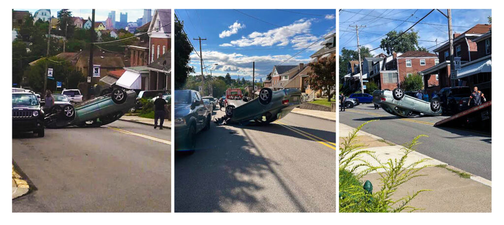
On the afternoon of Aug. 30, as this report was being finalized, another accident occurred on Greenfield Ave. A driver traveling east on the 800 block swerved and hit a legally parked truck, then flipped over. Fortunately, the couple and their young child who were in the car sustained no injuries.

Aug. 30 wreck on Greenfield Avenue
An eastbound car traveling along the 800 block of Greenfield Avenue flipped after hitting a parked truck on Aug. 30. Photo on left courtesy of Ed Goyda; center and right photos courtesy of Kris Olsen.

“Action is needed now”

DOMI’s intention to leave Greenfield Avenue as-is until reconstruction of Swinburne Bridge is finished prolongs conditions that put residents of all ages at risk. Cameron Grimes’ injuries have exacerbated Greenfielders’ frustration at DOMI’s neglect of basic safety improvements—especially as they see millions of tax dollars being spent on the very same solutions in more affluent surrounding communities.

“I understand there are needs throughout the entire city,” said Ms. Adams, “but it’s hard to be patient when pedestrians are getting hit by cars in your neighborhood.”

Asked what she would say to Mayor Gainey, Ms. Dekleva responded in an Aug. 27 email, “I would say this is an easy fix request being asked here; get a traffic engineering team activated and install traffic calming measures today, before another person is hit or killed. We don’t need a magic wand or any further extended theoretical deliberation…Action is needed now or more residents will be maimed or die from a problem the city can address today.”

Councilor Warwick told us, “Traffic calming doesn’t have to be complicated, and as a city, we need to be implementing simple, common-sense fixes while we work on larger-scale projects.”

Slow Down Greenfield rides again (soon)

Ms. Dekleva said she valued being part of this action with her neighbors and plans to schedule another one—possibly the weekend after Labor Day. 

She told us during an Aug. 21 phone call, “I think that the tremendous history of working-class solidarity is alive and well in Greenfield—something we all love about Greenfield. This is not something people will let go, and we will be heard for sure.”

Greenfield Boy Hit by Car Near Magee Playground

A pedestrian crossing sign was recently run over by a speeding car at Greenfield Ave. and Kaercher St., illustrating the need for better safety infrastructure.

On Aug. 16, a car struck 12-year-old Cameron Grimes as he and his sister began to cross Greenfield Avenue on their way home from Magee Playground.

Cameron’s mother, Leah Pugh, told us during an Aug. 17 phone call that he has a fractured arm and abrasions all over his body—including damage to his ear that will require surgery. “Other than that, he’s OK,” she said. Witnessing the accident had shaken Cameron’s 11-year-old sister Camella, but she was doing better at the time of our interview.

Neighborhood residents have been pleading with city officials for decades to address dangerous traffic patterns along Greenfield Avenue. In July, the Greenfield School Parent-Teacher Organization and the Greenfield Community Association co-sponsored a petition calling on Pittsburgh’s Department of Mobility and Infrastructure (DOMI) to make Greenfield Avenue safer.

Another accident years in the making

Greenfield School PTO secretary Marianne Holohan, who helped draft the petition, said an accident like this is exactly what she was afraid of.

The petition specifically names the part of Greenfield Avenue where Cameron was hit, noting that kids and seniors cross at its intersection with McCaslin Street to visit Magee Rec Center. It also points out the stretch between Kaercher and Irvine/Saline streets, where “despite the high number of crashes, nothing has been done.”

pictures of three car wrecks that occurred on or near Greenfield Avenue in 2022
(L-R) Emergency crews respond to a five-car accident on May 22, 2022, at the intersection of Greenfield and Hazelwood avenues; a car lies flipped on its side after a June 23, 2022, wreck on the 300 block of Greenfield Avenue that witnesses say required first responders to use Jaws of Life to rescue the driver; a car teeters at the top of a steep hill after jumping a curb on the same block of Greenfield Avenue on Dec. 31, 2022.

When Mayor Ed Gainey held a community meeting in Greenfield on Jan. 14, attendees identified conditions along Greenfield Avenue as their top concern. Mayor Gainey thanked the residents for sharing their needs and encouraged them to “be aggressive” in communicating with his office going forward.

According to DOMI, Greenfield Avenue qualifies for Pittsburgh’s Neighborhood Traffic Calming program. However, it still has not received funding for traffic-calming improvements despite ongoing requests from residents and this year’s formal budget request from the Greenfield Community Association. At a July 2022 meeting about the replacement of Swinburne Bridge, DOMI project manager Zachary Workman told residents that any changes to Greenfield Avenue would have to wait until construction of the new bridge is complete in 2026 or later. “It’s definitely something that’s on DOMI’s radar for improvements in the future but it’s in the long-range plan as resources become available.”

“Outside of projects in affluent East End neighborhoods, DOMI only seems to install traffic calming after someone has been hurt or killed,” Ms. Holohan commented in an Aug. 17 text. “We should not have to sacrifice our children for basic public safety.”

“That could be any kid”

Ms. Pugh stressed the importance of better traffic control on Greenfield Avenue, saying that what happened to her son isn’t unique. She works in Hazelwood and knew Jamel Austin, the Glen Hazel 6-year-old who was killed on Johnston Avenue last year after being hit by a car.

She was aware of Glen Hazel’s successful efforts to get traffic-calming measures on Johnston Avenue and around the neighborhood schools after Jamel’s tragic death. But she said that before Cameron’s accident she was not aware that Greenfield residents were also lobbying for traffic calming. Now, she said, she wants to bring as much attention to the problem as possible.

We asked Ms. Pugh what she would say if she could speak directly to Mayor Gainey and the public about Cameron’s accident. She responded, “[Magee Playground] belongs to every child. So in a sense, my son is everyone’s son. Many have and will cross this same street that cars will continue to speed through. Clearly, that is [the] root and reason for the petitions and pleas to the mayor and so forth. How much more effort is needed for basic residential safety?”

To sign the Keep Kids Safe with Traffic Calming on Greenfield Ave! petition and add your comments, visit https://forms.gle/CAFP9yHbshzM7Yfg9 or scan the QR code below.

QR code for Greenfield Avenue petition

City Council Legislation Aims to Protect Parks, Increase Transparency Around Grants

Photo and map of Junction Hollow

On June 21, Pittsburgh City Council passed Resolution 1619-2023, which formally recognizes 28 acres between Panther Hollow and The Run—known as Junction Hollow—as part of Schenley Park. The same day, they passed an ordinance (1620-2023) that got less attention at the time but could help any Pittsburgh resident who wants to have their say in the future of a city park.

District 5 councilor Barb Warwick introduced both pieces of legislation, stressing the importance of parks. In her resolution, she wrote that Junction Hollow provides recreational space and is vital for green stormwater management. She told the Pittsburgh Tribune-Review on June 7 that Junction Hollow “has been part of the park in layman’s terms for a long time, but it’s not officially designated as a park.”

Now, it enjoys the same protections as the rest of Schenley Park.

Councilor Warwick said during a July 7 phone call that her office is working to introduce related measures over the next few months. Their common goal is to prevent development-oriented projects like the now-defunct Mon-Oakland Connector (MOC) from being forced on communities that do not want them.

Lessons Learned from the Battle of Four Mile Run

“Throughout the MOC fight, the city was trying to turn a park into a shuttle road,” Councilor Warwick said. “The city’s argument was that it used to be a road; it didn’t matter that it’s a park now. [The resolution that passed] is just to make it clear that this is a park now.”

Residents in MOC-affected communities didn’t know that Pittsburgh’s Home Rule charter gives them the right to petition the city for a public hearing on what Ordinance 1620-2023 calls “the change of use of a City Park or Greenway.” And they could have bolstered their case against allowing the MOC in Schenley Park by citing a state law called the Donated or Dedicated Property Act. It says land donated or dedicated as a park cannot be taken out of the public trust to serve other purposes. The ordinance requires the city to tell petitioners that the Donated or Dedicated Property Act exists, and that they have a right to use it to defend public land.

Councilor Warwick said her office is working on legislation to introduce in the fall setting rules for development in city parks. Without changing zoning laws, she wants to focus development only on the public’s enjoyment of the parks. For example, the MOC was a roadway or thoroughfare intended to connect two neighborhoods, not promote use of the park itself.

At the time of our interview, Councilor Warwick was planning to introduce legislation on July 18 that would change the city’s process of applying for certain grants. When a city department decides to apply for a grant worth more than $250,000 or to fund a project that is not already in the capital budget, they would have to notify City Council before applying.

“It doesn’t give us a vote, but earlier on in the process, we have an opportunity to ask questions,” Councilor Warwick explained. “If we don’t support the project and they apply for the grant anyway, when the grant does come to a vote at the end there is a record of these issues.”

The point of involving City Council earlier, she said, is “ensuring that when the city is pursuing a grant for a project, it is one the community wants or has identified as a need. That’s all we should ever be doing, but the reality is it hasn’t been. Big, visionary things are fine, but we need to be focusing on the communities’ day-to-day needs.”

Shaping the Future of Sylvan Avenue Trail

Councilor Warwick saw firsthand how communities can be left out of deciding which projects to fund with grants. During a series of public meetings about the MOC in 2018-2019, the Department of Mobility and Infrastructure, known as DOMI, applied for a grant to build the Sylvan Avenue trail (part of the MOC route) without informing the public. After receiving the grant, they pushed the project through by raising the specter of leaving money on the proverbial table.

“If they were doing this now and notified me, I would have asked, ‘Why are we applying for this grant when there are so many other things that need to be done for Hazelwood?’” Councilor Warwick said.

But since the trail project is moving forward, she added that she intends to make the best of it. “We’re trying to put money toward creating a plan for the Sylvan Avenue trail instead of it just being a DOMI bike trail. We want to include a plan for the larger space because it is now a park.”

The trail is part of the Hazelwood Greenway, which was designated a city park in December 2021. That means it has the same current and future protections as Schenley Park.

“It’s going to take years, but whatever the design is for that trail, I want it to include what that park could look like 5 to 10 years from now with investment,” Councilor Warwick said. “It’s for the community, not just commuters passing through.”